I downloaded Google’s SketchUp software the other day hoping it would be helpful with drawing up a plan for a cattle shed (that’s still a few years off). As I was messing around with it, I found the “Add Location” tab that allows you to import an image from Google’s Map. I imported our property and was surprised to see it had been recently updated – there’s not much incentive for Google to up update rural Iowa very often, as it doesn’t change very rapidly. (I have proof of this I’ll show you in a later post I’m working on.)
I immediately knew when the photo was taken because there was a wagon sitting in the yard. The wagon was borrowed from my brother for a project I was working on late in May and only sat there for two days. That got me curious (the DW would say it doesn’t take much).
How quickly does Google cover an area when taking photos for their maps? The wagon had sat at my brother’s in-laws for a while before it was dropped off at my parent’s place. It stayed there for a day or two before I picked it up, filled it with compost, and parked it at my place. I unloaded the compost over the next two days and then parked the wagon behind the garden until my brother picked it up a couple weeks later. So what’s the point?
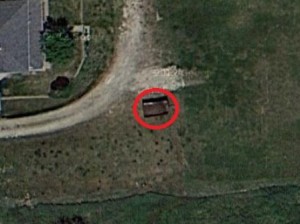
The wagon at our place
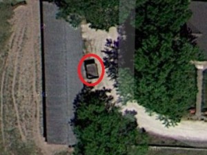
The wagon at my parents
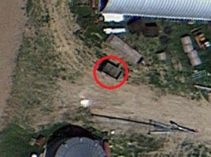
The wagon at my brother’s in-laws
Apparently, the wagon covered more ground than Google that week. Ironically, the only place the wagon doesn’t show up is at my brother’s.
