I stated in a post a few days ago that there wasn’t much incentive for Google to update its maps near our location because not much changes around here. Well, after getting side tracked by Google Maps, I went even further off track and started looking through some old USDA records. These USDA photos prove my point:
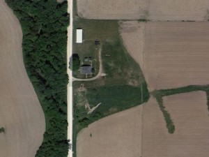
2012
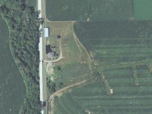
2011
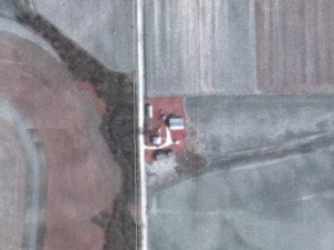
1980s
1970s
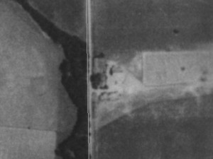
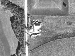
1930s
This wasn’t much of a surprise to us, as we knew the house and buildings were built pre-1920 and as you walk through the yard old concrete shows were the buildings missing today once stood. But, as I backed the shots out to a 10 mile by 10 mile square and compared the 1930s shot to the 2012 shot I was surprised to see not much had changed. The small towns were about the same size. The tree lines hadn’t shifted much. No new farmsteads had appeared and most of the old ones were still there and hadn’t changed significantly. Makes you wonder if it will still look the same 100 years from now.
